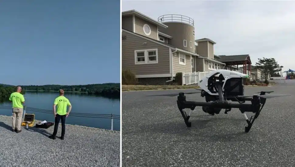

With drone flight technology, we are able to measure things that could never be measured before.
By capturing information from the air, we help our clients establish images of existing conditions, create reference points for future site considerations, see areas of concern that are hard to reach, and make educated decisions that we previously could not make.
At Spotts, Stevens, and McCoy, we have three certified FAA Remote Pilots on our team. Drone photography offers a powerful solution for monitoring progress on construction sites, capturing hard-to-reach details on elevated structures, roof inspections, and documenting infrastructure on expansive sites.
Spring is one of the best times to deploy drone technology or conventional aerial photography from fixed-wing aircraft for point data and image collection. Snow-free, leaf-free, and sunny conditions allow us to get the best picture and the most accurate information to enhance our clients’ projects.
Now is the best time to get your aerial mapping projects scheduled.
Common applications include:
- Construction Monitoring
- Volumetric Computations
- Site Design and System Layout
- Promotional Imagery
- Litigation Support
- Aerial Site Evaluation and Progress Reports
- Rooftop Condition Assessment
- Erosion and Damage Assessments
______________
Spotts, Stevens, and McCoy is a regional engineering, environmental, and surveying firm with an office in West Chester. We engineer solutions for a better world. Our work touches everyday life — from the water you drink, to the air you breathe, to the buildings and communities where you live, work, and play. Learn more about Spotts, Stevens, and McCoy.
______________
This video from Spotts, Stevens, and McCoy contains footage captured by drone technology for the purpose of a roof inspection.


")


")


")
")