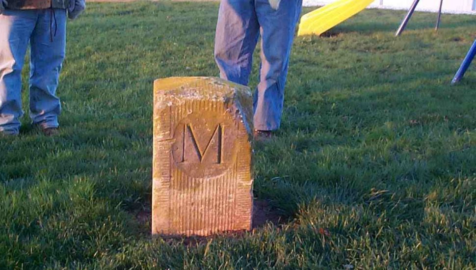
The 250-year-old stone markers along the historic Mason-Dixon Line, which separates southern Chester County from Cecil County (Md.), are in danger of disappearing, unless more effort is put into their preservation, writes William Ecenbarger for The Washington Post.
During the Civil War, the Mason-Dixon Line was the difference between freedom and slavery as it was the demarcation between the North and South. However, it was originally drawn to settle a dispute between the proprietary families of Pennsylvania (the Penns) and Maryland (the Calverts).
They commissioned a survey by two Englishmen, Charles Mason, an astronomer, and Jeremiah Dixon, a surveyor. Following their arrival in Philadelphia in 1763, they spent almost five years calculating the boundary between the two regions.
To do this, they established a temporary observatory in what is now Newlin Township in Chester County. Once they finished their calculations, they marked the 233-mile border with stones placed at one-mile intervals that have P for Pennsylvania on one side and M for Maryland on the other.
In 1990, a concerned group of surveyors formed the Mason and Dixon Line Preservation Partnership. It aimed to preserve the stones, but is now seriously underfunded, putting the stones’ future in jeopardy.
Read more about the Mason-Dixon Line stones in The Washington Post here.


")


")


")


")