FROM DELCO: Coverage of Shooting Wounds Neighborhood Advocates
If people don’t like unwelcome development in their backyard, they sure don’t like crime there.
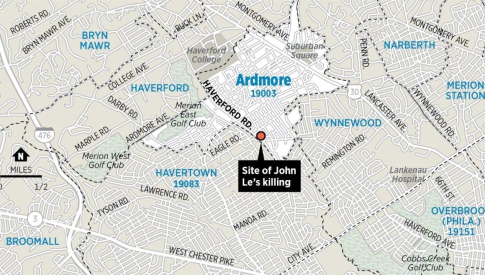
And in the last week, residents of Ardmore and its surrounding neighborhoods have defended their turf over a recent shooting that killed a 29-year-old man.
The incident took place near the border of two communities, two townships, and two counties. By some maps, it was close to both Ardmore and Havertown, and though it was clearly in Haverford Township, it was far from the unincorporated community of Haverford, according to a Philadelphia Inquirer report by Tommy Rowan and David Gambacorta.
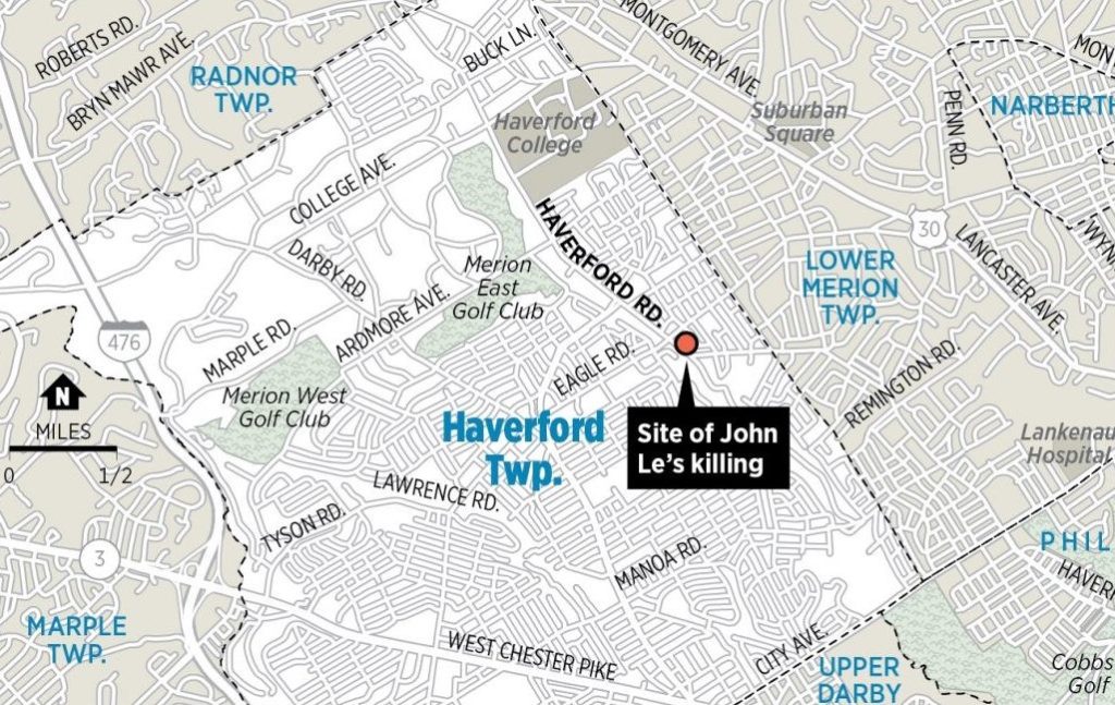
“We’re in a weird cut of the world,” said local employee Trudi Meyer of Wynnewood, another unincorporated community thrown into the mix by virtue of its location straddling both Haverford and Lower Merion townships.
It took a separate article to sort out the mess.
“Many locations are based on railroad stations and old country crossroads, not municipal boundaries,” said Philadelphia Media Network Assistant Managing Editor David Sullivan. “We have a (city) map we have used for decades defining neighborhood boundaries. But in the suburbs, it can be chancier.”
Read more about the confusion in the Philadelphia Inquirer here.
Connect With Your Community
Subscribe to stay informed!
"*" indicates required fields


")